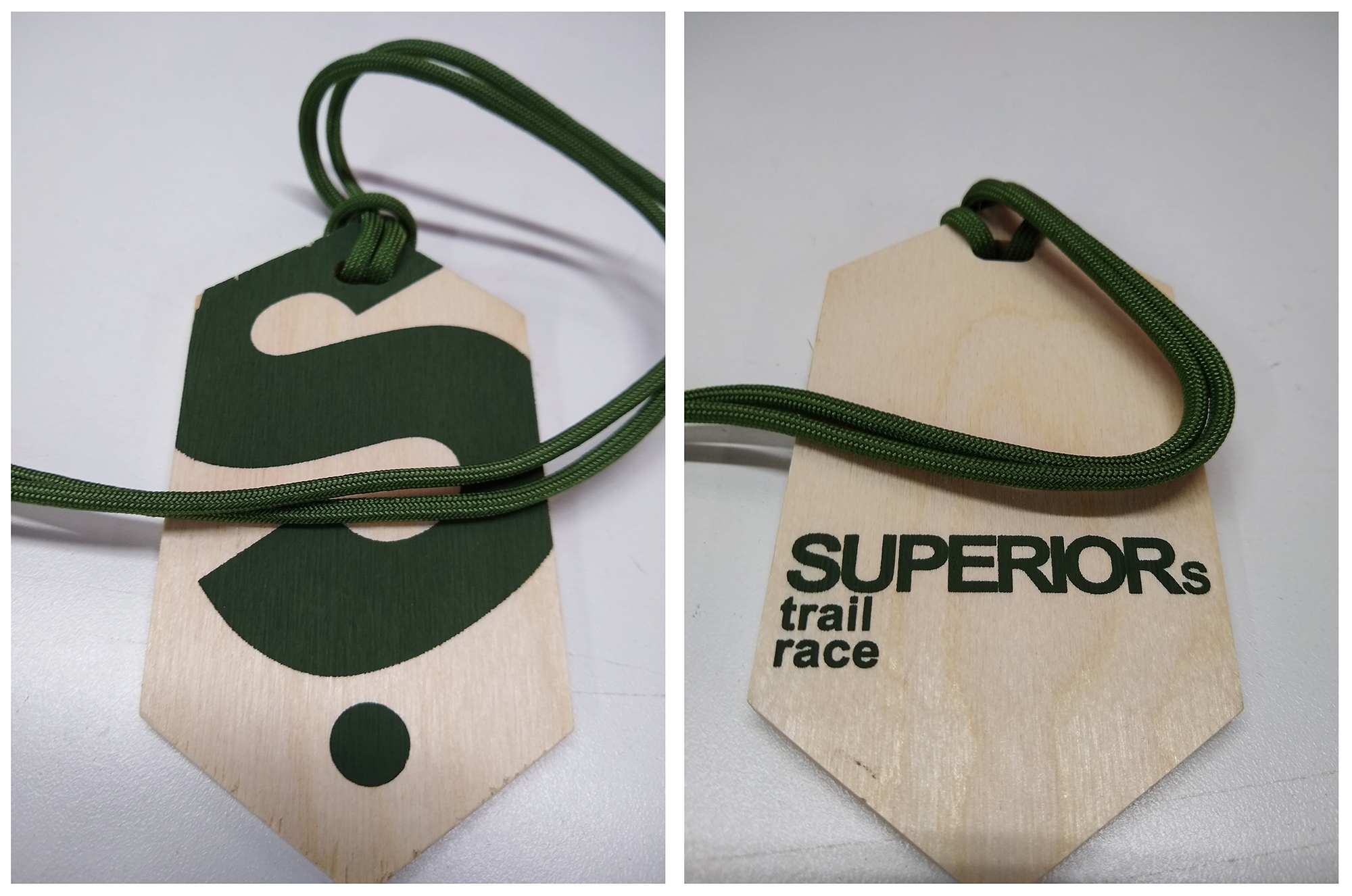
The Superior Spring Trail Race finishers Medals will be different in 2021, and quite possibly going forward. This is for a number of reasons. One is so that we can more easily ship them when needed. Secondly, my friend and former race director Larry and his wife Colleen spent years going into the woods, cutting trees, hauling them home, drying them, cutting them into discs with a miter saw, drying the discs more, screen-printing the fronts, then the backs, then drilling a hole, tying twine, separating into bins and getting them to me… four times a year, for our four major events, 1000’s of medals per year – it’s time we give them a little bit of a break. This new design is still printed on wood, it is clean and simple, and they are still made by some friends of ours, I really like it – I think you will too. I have removed the distances and year from the medal but have left a large space on the back if you want to write in a note with a fine-tipped sharpie; the year, the distance you ran, your time, or anything else, a memory perhaps. No more waste, no more throwing out or burning dated medals due to DNS or DNFs, etc.

Superior Spring Trail Race
50KM, 25KM & 12.5KM
Lutsen, Minnesota
Saturday May 16, 2020
50KM 7:00AM
25KM 8:00AM
12.5KM 9:00AM

Registration / Lottery:
Opens Wednesday January 1st, 2020 – 12:01AM CST
Closes Wednesday January 15th, 2020 – 11:59PM CST
* Due to high demand, registration for the Superior “Spring” Trail Race is held via a lottery, more details about the lottery can be found HERE

Directions to Race Start:
Caribou Highlands Resort / Lodge
371 Ski Hill Road
Lutsen, MN 55612
Google Maps Directions HERE
Approx Travel Times
1:15 North of Two Harbors, MN
1:45 North of Duluth, MN
4:00 North of Minneapolis, MN

Terrain / Course Description:
The Superior 12.5KM, 25KM and 50KM Trail Races are extremely hilly, rugged and technical out-and-back (100% trail) trail-races which traverses the Sawtooth Mountain Range on the Superior Hiking Trail in the far reaches northern Minnesota .  The course parallels Lake Superior, the greatest freshwater lake in the world, climbs to near 2000′ peaks with breath-taking vistas of the lake and inland forests and crosses whitewater rivers and serene streams while meandering through mystic Boreal forests.  The races start and finish at Caribou Highlands Resort in Lutsen Minnesota.

Superior 50KM
25KM Out & Back Course = 50KM (31MI)
Elevation Gain 4,200 FT
Elevation Loss 4,200 FT
NET Elevation Change 8,400 FT
4 Aid Stations
9 Hour Time Limit
Starts at 7:00AM Saturday
Compete 50KM Info HERE

Superior 25KM
12.5KM Out & Back Course = 25KM (15.1MI)
Elevation Gain 2,300 FT
Elevation Loss 2,300 FT
NET Elevation Change 4,600 FT
1 Aid Station
8 Hour Time Limit
Starts Saturday at 8:00AM
Complete 25KM Info HERE

Superior 12.5KM
12.5KM Point to Point Course. 12.5KM = 7.75MI
Elevation Gain  900 FT
Elevation Loss 1,050 FT
NET Elevation Change 1,950 FT
NO Aid Stations
7 Hour Time Limit
Starts Saturday at 9:00AM
Complete 12.5KM Info HERE

More About the Area:
The North Shore of Lake Superior runs from Duluth, Minnesota at the Southwestern end of the lake, to Thunder Bay and Nipigon, Ontario, Canada, in the North to Sault Ste. Marie, Ontario, in the east. The shore is characterized by alternating rocky cliffs and cobblestone beaches, with rolling hills and ridges covered in boreal forest inland from the lake, through which scenic rivers and waterfalls descend as they flow to Lake Superior. The shoreline between the city of Duluth to the international border at Grand Portage as the North Shore.  Lake Superior is considered the largest freshwater lake in the world by surface area. It is the world’s third-largest freshwater lake by volume and the largest by volume in North America.  The Superior Hiking Trail, also known as the SHT, is a 310-mile long distance hiking single-track hiking trail in Northeastern Minnesota that follows the ridgeline overlooking Lake Superior for most of its length. The trail travels through forests of birch, aspen, pine, fir, and cedar. Hikers and runners enjoy views of boreal forests, the Sawtooth Mountains, babbling brooks, rushing waterfalls, and abundant wildlife. The lowest point on the trail is 602 feet above sea level and the highest point is 1,829 feet above sea level.